Entry #38: Mile 137, Old Lyme, Connecticut. Crossing Connecticut

It is raining in Niantic as I head out the door of the Niantic Inn after a fitful night’s sleep. Maybe it was the giant plate of fried clams I ate at Skipper’s Seafood, a popular, typically New England summer seafood restaurant on the road coming off the bridge over the “rope ferry.” Cesar, the manager, was reading the paper when I came in close to seven last night as the place was empty. A few weeks ago it was mobbed with vacationers but once Labor Day passes the resort towns of coastal Connecticut become more like normal towns, and Skipper’s on a Tuesday in October is as quiet as can be. The clams are great-- Cesar made them fresh for me and then shut down the restaurant a little while after making my dinner as it was obvious I would be the last customer.
How is it that a man from Ecuador is making my New England fried clams in Connecticut? Cesar originally moved to Spain but realized from the stories of relatives in the United States that he could make more money here so he came to work since he had relatives in Connecticut. The only complaint he had was that he had no idea there were four seasons because his image of the US was primarily one of California; he was quite surprised when winter arrived that first year. Now he has been here twelve years and has two kids and no plans to go back. He tells me “my home town has changed and I have changed. Plus, I would not want my kids to have the life I had. It’s better here. Sure I go back to see my family and friends, but this is my home. It’s nice and it’s quiet and the schools are good. My kids will have a better life than me. Maybe someday I will open my own restaurant, but I like this place and the people are good to me.” It’s not quite the iconic American Dream, but it is a more reasonable version and probably one that is more common than the idealized version of rags to riches.
*****
A poor night’s sleep and a steady drizzle are not exactly helpful when faced with the prospect of a fifteen mile walk. I use the Niantic Diner, located a half-mile west of the Niantic Inn to prime the pump, so to speak. Once I get going I will be more inclined to keep moving and once committed to the walk I cannot find reasons to delay the journey for a day and hang out in one of the cafes reading or browsing in the bookstore nearby. The Niantic Diner has no clients under the age of 65 except me. Every elderly person for ten miles around must have been summoned here this morning because the lot is full of big old American cars, replete with yellow ribbon and American flag “support our troops” bumper stickers-- you know the type-- think your grandfather’s Oldsmobile--and the place is packed. The food is pretty good as diner breakfast food goes. As I finish up my coffee and get ready to head out I look outside and see that it is now pouring with rain.
After another cup of coffee it is still raining hard, so I opt for plan B--I see a bookstore across the street--and I scurry over quickly to pass the time until the rain lets up. The store is called the Book Barn and is one of the most eccentric bookstores I have ever visited. It is made up of a large house with books filling every room, including the basement. The grounds are covered with small buildings, some look like beach shacks, some are old sheds, some are just made of planks of wood covered by tarpaulin. Each “building” contains one or two categories of books, Science, or The Occult, for example, and at least one cat. There seems to be no logic at all to the distribution of subjects, but the manager easily recalls where all the subjects are stored. In the American History area, I find eight to ten copies each of all the books I have been using for this project as well as many other interesting books. I end up buying a couple of large books, which I have shipped home, and one book to carry along with me (as if I need more stuff to carry) completely unrelated to my project, Steve Olson’s Mapping Human History: Genes, Race, and our Common Origins, which turns out to be quite interesting. That is for another day and a different project.
*****
The rain continues to come down for another hour, and as I look out at the sky for signs of a break in the clouds, I see that opposite the bookstore, near the diner, is a street called Black Point Road. I recall that yesterday I read that there was a 256 acre reservation for the Niantic Indians on Black Point until well into the nineteenth century when the tribe was declared “extinct.” (1) Hamilton, in his diary of 1744, records that “a little after I passed this [the rope] ferry I rid close by an Indian town upon the left hand situated at the brow of a hill. This town is called Nantique and consists of 13 or 14 wig-wams made of bark.”(2) John Winthrop Jr. also mentions the Niantic as he passed “an Indian fort at Niantiga, but the Indians were all away with their homes.” (3) This is a reference to the fact that Indians often took up the covering for their shelters and left the frames behind when they moved to their alternative lodgings as the seasons changed.
The village of Niantic is today a part of East Lyme, Connecticut, a town that was founded in 1839 from parts of Waterford and Lyme. The town of East Lyme has a population of 18,500 and has two villages within its jurisdiction: Niantic, near the coast, and Flanders, to the north, the original settlement in the area before Niantic became a resort. A little past the Book Barn is a junction where the road from Flanders and the road from the Rope Ferry meet. Anybody who traveled around the head of the Niantic River and through Flanders would rejoin the road to Saybrook Ferry here. Niantic is a word in the local dialect which means “sand bar” or perhaps “sandy point,” a reference to the spit that reaches across Niantic River. I must be learning some Algonkian as I recognize the prefix Niant in the name of the town of Nahant near Boston, which is similarly named after the sandy peninsula on which the town is located.
Finally the rain lets up a little, and I head out into the light rain determined to save something of the day. Forward progress, one step at a time.
*****
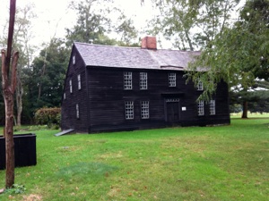
Niantic on a rainy morning: Clockwise from top left. 1. One of the many cats lounging among the books at the Book Barn. 2. Rainy corner of Main Street (the road to Saybrook) and Black Point Road, which once marked the entrance to the Niantic Reservation which Hamilton passed in 1744. 3. “Camp Niantic by the Atlantic Family Campground.” 4. Thomas Lee House, c. 1660.
The rain starts again almost as soon as I leave the Book Barn. About a half mile along a woman pulls over and offers me a ride! After 200 miles this is the first person to offer me a ride. Her name is Joanne, and she is a middle age woman puffing away on a cigarette in her Ford Taurus. I explain what I am doing and thank her and she asks me if my project is for charity or something. I tell her she is a very nice person to have offered me a ride, and she almost starts to cry, says “God Bless you,” and heads back down the road, leaving me in the rain as I requested.
After half an hour’s walk I reach the Thomas Lee house which dates to circa 1660. The Lee family were original settlers of the Saybrook Colony, which included what became Lyme east of the Connecticut River. When Winthrop founded New London in 1646, the boundary between the two colonies was disputed. Two different stories, both probably apocryphal, have been passed down about the settlement of the border dispute. The first one involves a small stream just past the Lee house called Bride Brook. Winthrop was at the time of the story a magistrate of the Pequot Colony, which became New London. According to testimony given years later by Winthrop in an effort to establish the boundary, a couple in Lyme wanted to be married but, owing to the depth of the snow, a magistrate was unable to come from Saybrook to officiate. Whereupon it was agreed that Winthrop would meet the couple at Bride Brook, and that he would marry them while standing on the east bank of the brook, thus staying within his jurisdiction, while the couple stood on the opposite shore, in the jurisdiction of Saybrook. (4)
A second story, told years later by Timothy Dwight, the President of Yale College and author of the four volume Travels in New England and New York, published in 1821, four years after his death, claims that the border problem was settled by a fistfight, involving two men selected from each town, won by the men of Lyme. No matter how it was settled, the town of East Lyme today contains pieces derived from both the original Saybrook Colony and the New London Colony. (5)
Bride Brook runs to the sea through the beautiful Rocky Neck State Park on the left side of Main Street (also known as Route 156, the Lower Road to Saybrook Ferry, or the Old Post Road). I cross Bride Brook after reading the plaque commemorating Winthrop’s marriage ceremony and follow the northern border of Rocky Neck State Park, passing Camp Niantic by the Atlantic Family Campground until I reach the Four-Mile River, which marks the boundary of the park and the border between the towns of East Lyme and Old Lyme.
*****
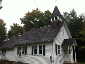
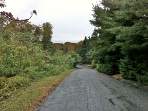
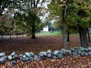
Walking through the backroads of Old Lyme Connecticut. Clockwise from top left: 1. South Lyme Chapel, a tiny church on Mile Creek Road. 2. Horse farm with stone wall in Autumn. 3. The footwear is improving, but it’s not shorts weather anymore. 4. Johnny Cake Hill Road, a great name for an old road in New England.
Old Lyme presents a small problem. After ten minutes the road splits: To reach the historic center of Lyme I have a choice either of continuing on Route 156, which is called Shore Road now and passes south and then west before turning north again, or of turning right here onto Mile Creek Road, which winds through hills and valleys for four miles before rejoining Route 156 on the edge of Old Lyme Center. Shore Road on the map looks more developed, is straighter and a half mile shorter than Mile Creek Road, and crosses through some marshland, all of which make me think it is not the oldest road. I also discovered an old map of the area drawn in 1758 by Ezra Stiles, which shows the road heading more directly from Niantic at some distance from the shoreline. (6)
I decide to try Mile Creek Road and once again am rewarded almost immediately when I pass the South Lyme Chapel of the First Congregational Church of Old Lyme. At 244 Mile Creek Road I pass the Captain Chadwick House from 1690 and quickly pass another seventeenth-century house, indicating that this road dates from the seventeenth century. The road is quite scenic although there is a steady line of houses on both sides of the street. I would not exactly call it suburban, but it is not rural either so I will call it a “subrural” neighborhood. I pass the Waite Family Cemetery which has gravestones from the early eighteenth century. I stop in the cemetery for a quick rest on the stone wall and notice that the rain has slowed to a steady drizzle. I retie my laces and stretch my feet: now that I have hiking shoes on I don’t have blisters but my feet are still tired. The sound of a Red-Bellied Woodpecker echoes around the cemetery. I finish my snack and drink and start off again.
Shortly I reach an area of scenic horse farms, then I cross a small bridge across a beautiful salt marsh where I see herons, kingfishers, ducks, and empty osprey nests as they have now headed to the Gulf Coast on their way to South America for the winter. The salt marsh grass reminds me that I am in the town for which Lyme Disease is named. Lyme disease, a bacterial disease that can cause neurological damage and rheumatoid arthritis if left untreated and now known to be transmitted by the deer tick, was first observed in this area in the 1970s. Interestingly, it is now thought that Lyme disease was quite prevalent in the colonial period, but that the deforestation of New England that accompanied the rise of large scale farming in the colonial period resulted in a smaller deer population and fewer ticks, which caused the disease to essentially “disappear” for almost three centuries. It’s reappearance has been blamed on the abandonment of farming in New England and the concomitant reappearance of forests, accompanied by the rapid suburbanization that followed World War Two, which resulted in the growth of “subrural” neighborhoods just like the one I am passing through, with lots of houses but also lots of woods and deer. I must remember to do a tick check when I turn in tonight.
*****
Fifteen minutes after crossing over what I think is Mile Creek I rejoin Shore Road with the intention of following it into Old Lyme. However at that same intersection is a small street heading uphill called Johnny Cake Hill Road. I had read that the old meetinghouse was originally located on Johnny Cake Hill Road so I decide to follow the road and see where it goes, expecting it to be the dead end it appears to be on the map, but hoping that something might come of it. Soon the road peters out as it reaches the railroad tracks, but a small footbridge crosses over the tracks, and on the other side I find myself back on Johnny Cake Hill Road which is a very narrow and windy road that runs up and down hill through the Old Lyme Country Club, past seventeenth century houses, and with views over the surrounding flatlands of salt marsh, creeks, farms, and houses.
At the top of an incline I reach a stone with a marker on it indicating the site of the original meetinghouse, first constructed in 1665 at the time of separation of Saybrook and Old Lyme. The split of the Saybrook Colony into two towns on either side of the Connecticut River was referred to as “the loving parting” because the parties agreed quite easily to separate so that residents of Lyme might build their own meetinghouse and thus avoid the sometimes difficult crossing of the Connecticut River in order to go to church. The first minister of Lyme was Moses Noyes, who preached from 1669 until his death in 1729, and oversaw the construction of the second meetinghouse to replace the first one in 1689. A third meetinghouse was built in 1738 under the direction of the third minister, Jonathan Parsons who, as a “New Light,” was deeply influenced by the teachings of George Whitefield. The controversial Whitefield preached here on August 12, 1745 to a crowd that was so large that he preached outside from a nearby rock. In 1815 the third meetinghouse was struck by lightning and the fourth building was constructed down the hill near to the center of Old Lyme. I head downhill and pass over the Duck River, past a cemetery, and soon reach the present church, the fifth meetinghouse, built in 1910 on the site of the fourth building which burned in 1907.(7)
The meetinghouse is across the street from Old Lyme Green at a bend in the road, which changes to Lyme Street at this point. In fact the church is at the intersection of Lyme Street and Ferry Road which presents a dilemma. Ferry Road heads directly down to the Connecticut River, but I will be crossing the river over the Connecticut River Bridge at least a mile upriver. I decide to walk Ferry Road all the way to the site of the old ferry across to Saybrook, then retrace my steps to this spot, head through Old Lyme, cross the bridge, find my way to the ferry landing site in Old Saybrook, and then continue from there. This will add a significant amount of walking to my total, and I will be interested to see how many extra miles I need to walk in order to do what Hamilton, Knight, and others did by taking a boat the half mile across the river. (It is 4.7 miles in fact to go from ferry landing to ferry landing via the bridge, compared to less than a mile by boat. But then I did not have to listen to “a rabble of clowns who fell to disputing upon points of divinity as learnedly as if they had been professional theologues” as Hamilton was forced to while waiting to cross the river).
I head down Ferry Road and reach Shore Road once again. This road crosses the surprisingly wide Lieutenant River, and I rejoin Ferry Road on the opposite shore, turn left and head up a small hill and then start down towards the Connecticut River. As I walk along I spot a truly exciting milestone in the grass on a small incline by the side of the road: a stone marker which reads “15 Miles NL.” This stone marker was supposedly placed by Benjamin Franklin in 1755 as he surveyed the road in his position as deputy postmaster general, responsible for all of the northern colonies, although there is no date on the stone itself. The reference on the stone to 15 miles to (presumably) New London, indicates that this indeed was the main route to New London and that my choice of routes is correct and that each step has been worthwhile. A few yards further on I reach a small beach that faces across the river to Old Saybrook.
Hamilton reports that he was obliged first to pay eight pence to cross the toll bridge (“in very bad repair”) over the Lieutenant River, then “coming down to Seabrook Ferry upon Connecticut River, I waited 3 or 4 hours att the house of one Mather before I could get passage. The wind blew so hard att Northwest with an ebb tide which, the ferryman told me, would have carried us out into the Sound had we attempted to pass...I crossed the ferry att 5 o’clock.” (Hamilton, August 27, 1744) Winthrop too had trouble crossing the Connecticut River in November 1645, recording on November 25 that after three days waiting he “crossed the river with the waves so high that they often came into the boat with great violence...but with God’s help we reached the shore safely.” Although the river is calm today I will not seek God’s help, but rather will cross on foot over the bridge. So I turn from the river, head back up the hill, and retrace my steps to the church in Old Lyme Center.
The only option for food in the center of Old Lyme is the Olde Lyme Ice Cream Shoppe, which incongruously serves great sandwiches. After a long walk I feel justified in ordering the Dagwood from Jason who owns the place. He likes Lyme a lot especially after living in South Boston for a number of years. He says it is still the kind of place where you can leave your car doors unlocked. It certainly does a fair impersonation of Bedford Falls; I half expect George Bailey to come ambling down Lyme Street. Eventually Lyme Street passes under Interstate 95, I take a left onto Hall Street (Route 1), follow this past the Old Lyme Shopping Center, and soon reach a path that takes me up onto the bridge over the river. The river is impressively large when seen from up high on the bridge. The views are fantastic; the elegant New England towns below on each bank of the river, great swathes of salt marsh, hills stretching off into the distance, the wide mouth of the river where the snowmelt and rain of northern New England pours into Long Island Sound, and the hills of Long Island in the distance beyond the river mouth are all there to take in as the sun sets over the western hills.
I descend from the bridge, turn right, and reach Ferry Road on the Saybrook side. Ferry Road runs parallel to the river for a short distance until it reaches the ferry dock, where the road turns sharply right and heads west away from the river. I pass the Whittlesey House at 40 Ferry Road, from the late seventeenth century, which is listed as a tavern in Low’s Almanac of 1775, located at Saybrook Ferry. Whittlesey had acquired the ferry rights on the Saybrook side in 1720 after offering to pay for road improvements and build a proper wharf. Prior to this time people were “put to great inconvenience on account of there being no wharf on the Saybrook side and by reason of the uncertainty and alterations frequently made in the road leading to the ferry. (8).
It is rapidly getting dark, the highway runs parallel to Ferry Road, the center of Old Saybrook is still three miles away, and I am tired. So I look for the nearest motel at the highway exit ramp and settle in for the evening with my notes at the Liberty Inn. Although this day has been spent passing through quiet rural areas and a couple of charming old towns, I feel as though I have seen a great deal today. I have had the time to walk slowly and look around, to get a sense of the hills and valleys travelers of another time would have been more aware of than we who travel in modern forms of conveyance, and I have a sense of the great size and potential danger of the barriers such as the Connecticut River, over which travelers had to pass on their journeys. In the last twenty-fours hours I have reflected on some very diverse, topics including Ecuadoran immigration, Lyme Disease, the religious development of the United States, and the best way to cook hash browns. It’s fair to say that every step has been informative and a whole journey in itself.
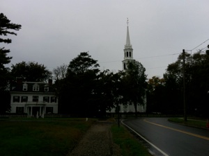
Old Lyme Connecticut. Clockwise from top left: 1. Ferry Road ends at a beach on the Connecticut River. Across the river is Old Saybrook, from which Old Lyme separated in the “Loving Parting” of 1665. 2. Congregational Meetinghouse in Old Lyme. Again proof that I was there and that it was raining (or is it all a photoshop fantasy?). 3. Coming into the center of Old Lyme in the rain. It’s still pretty. 4. Milestone on Ferry Road indicating 15 miles to (or from) New London. First milestone since Newport, Rhode Island.
Tuesday, October 26, 2010

Walking the Post Road
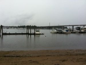
Connecticut River from the bridge looking south. The hills of Long Island are visible in the distance, beyond the mouth of the river.
“To finish the moment, to find the journey’s end in every step of the road, to live the greatest number of good hours, is wisdom.”
Ralph Waldo Emerson, “Experience,” in The Essays of Ralph Waldo Emerson, Second Series (Cambridge: Riverside Press, 1883), 62. first published 1844.
Distance Covered in this entry: 15.28
Total Distance covered in Connecticut: 42.29 miles
Total Distance Covered for this Project: 212.9 miles
Notes
-
1.Frances Manwaring Caulkins, History of New London, Connecticut (New London: Utley, 1895), 617.
-
2. Alexander Hamilton, Itinerarium, August 27, 1744.
-
3. John Winthrop, Jr., November 25, 1645.
-
4. As told by Pliny Leroy Howard, History of Eastern Connecticut, 3 Volumes (Chicago, 1932), Volume I, 127.
-
5. Caulkins, 171.
-
6. From Beinecke Library at Yale University. reproduced in Bruce P. Stark, Lyme, Connecticut: From Founding to Independence, (self published, 1976), page 42.
-
8. Saybrook Tercentenary Committee, In the Land of the Patentees: Saybrook in Connecticut (Acton Library, Saybrook, CT, 1935), 177.


