Entry #21: Mile 50, Providence. Brownian Motion

Two Hundred Miles to go until I reach New York. A day of wandering like the one I describe below will not get me there very fast. I had fun though, and I learned quite a bit about Providence and Rhode Island. I will be there ere long in the words of the song, but I plan on taking my time and savoring the sites, sounds, flavors, and smells along the way. Thus far I have averaged about 3 miles per entry. Although I suspect that average will increase, I estimate that I am about a quarter of the way through my journey. As I move further from home, I slowly leave behind the links that allow me to stay connected such as the commuter rail and the buses. The homes of most of my friends have been left behind, and as I meander through the city of Providence I feel I am entering a new phase in this project. Thus far I have been able to travel for a few miles and then write up my entries at leisure in my office. But the commuter rail does not extend beyond Providence so day trips become an increasingly difficult option to pursue. I will have to spend longer stretches of time on the road, and I worry that the entries will be of a lower quality as I spend more time walking than writing. On the other hand, if I continue at the current pace I may not get to Broadway before the first snowfall, one of my main objectives. Life is so full of compromises, and I am not much of a compromiser. But compromise I must, and here is where the rubber (in this case my Keens) hits the road. But today I will have one day of indulgence.
*****
Providence is a beautiful city. Not everybody will agree with this sentiment, and I admit there is plenty of blight (strangely, a great deal of it is to be found surrounding the massive State House, a pile so grand I can’t help thinking Rhode Island has a bit of a Napoleon complex), but the architecture is so diverse and the hills allow the many lovely steeples and domes to rise even higher over the verdant landscape, and the city is compact enough and old enough to have evolved several completely distinct neighborhoods, each with unique buildings specific to the era in which the area first developed, and the restaurants and cafes are of a higher quality than most cities of this size, and the city’s history is so rich and complex and representative of the evolution of American culture, and the ethnic melting pot that is Providence adds yet another layer of complexity to this, the second largest city in New England ...deep breath...that I have the urge to wander in every direction, down every alley, up every hill, through every park and arcade and plaza, along the newly restored river walk and across the bridges, until I have covered every square foot of the city founded by Roger Williams in 1636. I will call what I do today a “Random Walk in History” (with apologies to Howard Berg).
Below is a map that indicates, using various colors, the walk I describe today. Red, purple, and blue lines indicate routes actually taken by seventeenth- and eighteenth-century travelers (click on the lines for more information). Lime green lines indicate the portions of my walk not directly related to the Post Road, but which are helpful in giving me a sense of time and space and context. The green lines also represent much of the research that I usually leave out of these entries. Just this once I will let the reader in on some of the fun.
Except that I need to maintain the interest of my readers and uphold my resolve to stick to the original roads as much as possible. I did it in Boston, hewing closely to Washington Street and avoiding the temptation to gaze down Franklin Street and wander up School Street, averting my eyes from the lure of Bromfield and Essex Streets as Lot did on his flight from Sodom. But Boston, as I have described, had one and only one road out of town whereas the colonial traveler from Boston making his way through Providence had at least three roads to choose from to leave Providence in the direction of Newport or New York. Standing in front of the visitors center of the Roger Williams National Memorial the traveler could head down Main Street to Wickenden Street from whence he could follow the old Indian trail, in earliest days called the Watchemoket trail,to India Point, where a ferry waited to aid the traveler in crossing the mouth of the Seekonk River. Alternatively he or she could head up and over the hills east of the Providence River to the old Wampanoag trail, roughly parallel to today’s Angell Street, to another ferry across the Seekonk to what has been variously known as Rehoboth, Seekonk, Rumford, and East Providence. If the traveler to New York had no intention of visiting Bristol or Newport, he or she could cross the Providence River at Weybosset Bridge and head down what is Weybosset Street, which became the Pawtuxet Road and continued south as the Pequot path down the western shore of Narragansett Bay.
Hamilton in 1744 visited Providence on his return voyage, continuing on to Newport via the India Ferry, while Sarah Kemble Knight, traveling in an era prior to the construction of the bridge over Pawtucket Falls, traveled down the east side of the Seekonk River and crossed the river at the Upper Ferry to Providence. She then crossed the Eastside of Providence, then the Providence River and continued to New London on the Pequot Path. It is my intention to follow both roads, down the east and west shores of Narragansett Bay and to link them together at Narragansett to complete a loop around the bay.
The plethora of possible pathways allows me the luxury of wandering around Providence and soaking in the sights on a sunny summer day. But I must maintain some sense of purpose so I decide to limit the narrative of today’s peregrinations to the East Side of Providence, the site of the original settlement, the site of almost all of colonial Providence’s population, and the site of Brown University. I will follow the paths leading to Newport in this entry and in future entries continue down the East Bay through Barrington, Warren, Bristol, cross over to Rhode Island (the actual island for which the state is named) and follow the trail down to the southern tip at Newport. After completing the Newport segment, I will then return to Providence and follow the path of Sarah Kemble Knight across Weybosset Bridge and through the nineteenth-and twentieth-century commercial and cultural center of Providence, continuing along the Pawtuxet Road and following the old road into Narragansett Country. So let’s begin this adventure.
*****
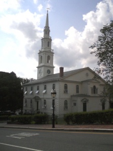
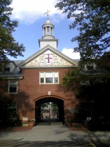
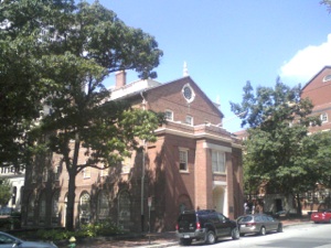
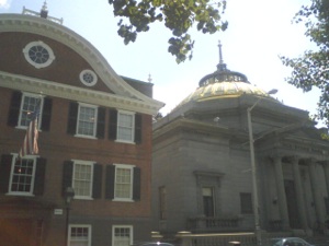
Clockwise from top left: First Baptist Church, the first Baptist church in America, founded 1638. John Brown House, built in 1786, College Hill. Wayland Tower on the campus of Brown University. The Market House in Market Square, commercial center of colonial Providence.
The Map above shows the route of the Post Road from Market Square to India Point (marked by the “Brown” line), the official Post Road portion of today’s walk. The Map below by Henry Chace shows the few roads in Providence in 1650 as well as the site of the two ferries over the Seekonk River. Also included are trails in and out of Providence and property owners. Note that nobody lives west of the the Providence River.
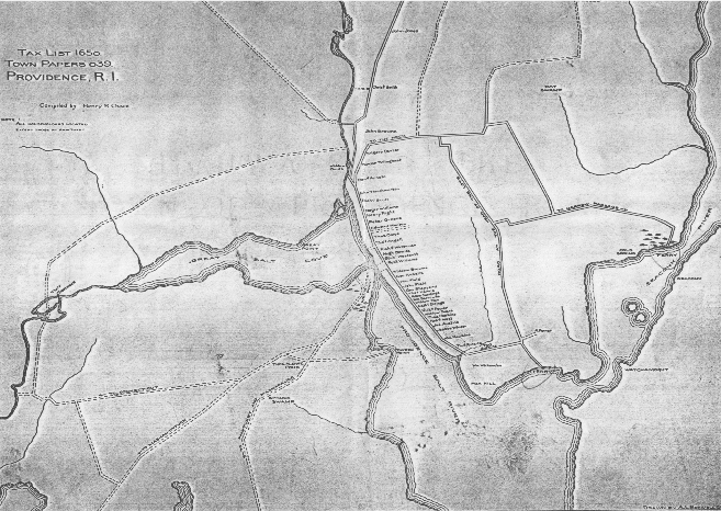
The two names most firmly associated with Providence are Roger Williams and John Brown. Williams received the land now known as Providence from the Narragansett Indians in 1636 at the confluence of the Providence and Seekonk Rivers, which allowed him a measure of safety after his own wandering from Cambridge to London to Boston to Salem to Plymouth to what is now East Providence, always chased out of town for his outspoken and controversial religious views. As I discussed in the last entry Roger Williams’s toleration of people of diverse religious backgrounds was a hallmark of the Rhode Island Colony and was later enshrined in the First Amendment of the United States Constitution. As an interlocutor with the Narragansett Indians Williams played a pivotal role in Indian-English relations through most of the first half century of English colonization of New England and I will return to this topic in future entries.
The evidence of Roger Williams’s influence is clearly visible in the multitude of church steeples of many religious denominations that dominate the Providence skyline. Perhaps the most important of these is the First Baptist Church, half a mile south of Roger Williams National Memorial on Main Street between Thomas and Waterman Streets. This congregation was established by Williams himself in 1638 and was the first Baptist congregation in America.
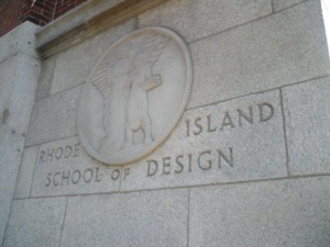
Just beyond the Baptist Meetinghouse are some of the many buildings of the other important educational institution in Eastside Providence, the Rhode Island School of Design. The collection of buildings that comprise the college are diverse and eclectic, perhaps unsurprising given that this is the school that produced Talking Heads. Interspersed among these and other institutional buildings on Main Street such as courthouses, the Market House, the beautiful Old Stone Bank, are many small bars and restaurants, which come alive at night especially. Perhaps it is not a shock to find a multitude of drinking establishments in a town where college students comprise such a large and important segment of the population, but Providence has since the earliest days been almost as receptive to watering holes as it has to churches. In 1750 thirty taverns were licensed to operate in Providence, serving fewer than 4,000 inhabitants. Hamilton stopped for breakfast on August 18, 1744 at the tavern run by Joseph Angell, whose religious opinions, Hamilton found “as much out of the common road as the man himself” (Hamilton, p. 149).
Looming over Main Street is College Hill, the home of Brown University since 1770. The Brown family had a large financial role in the early establishment of the college and John Brown served as Treasurer from 1775 to 1796. Many other members of the Brown family were involved with the college at all levels and it is actually named for John’s nephew Nicholas. John Brown, though, was the financial giant of the Brown family. Probably most well known as a prominent slave trader, Brown foresaw that the newer, larger ships being built could not make the voyage up the Providence River and was instrumental in developing what was, in the eighteenth century, unused land at what is now India Point Park into docks capable of handling larger ships. These ships engaged in trade with merchants in China and the East Indies, and brought fabulous wealth to the Brown family, best illustrated by the massive mansion located one block behind Main Street uphill at Benefit and Power Streets. The lovely buildings that line Benefit Street from end to end are ample proof of the wealth acquired by Providence merchants in the first decades after the Revolutionary War. It is at this point in history that Providence began its rapid population increase that led it to become the principal town in Rhode Island after over a century of dominance by Newport.
Main Street becomes less and less inviting as I near Fox Point. Interstate 195 blocks access to the sea, and the old industrial and commercial areas along the waterfront have today almost all closed and fallen into disrepair. I turn left onto Wickenden Street, another of the two or three oldest streets in Providence. Wickenden Street today is an arty street lined with antique shops, cafes, small restaurants, second-hand clothing shops and has a generally bohemian chic vibe. Just past the intersection with Hope Street, which in the early days of Providence was called Ferry Road, there is a short street that leads to a bridge over Interstate 195 to the lovely India Point Park, reclaimed from the decrepit and abandoned wharves that formerly provided so much wealth to the burghers of Providence. The park has a pleasant path along the shore of the harbor that leads out to India Point. This is the site of the ferry that Hamilton would have taken over the Seekonk River to what was, until 1862, Massachusetts. The ferry in 1744 was run by Josiah Fuller and was sometimes called Lower Ferry. Nearby is a wayside indicating that the area was also the site of Roger Williams’s first landfall in Providence in 1636.
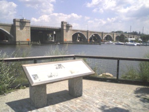
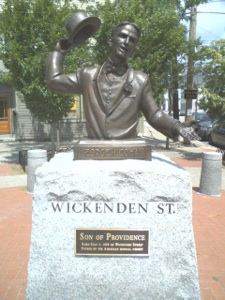
I gaze out over the Seekonk River at the Washington Bridge that crosses the river. Interstate 195, US 44, and US 6 all cross here, which indicates the importance of the area as a transit crossing point. Fortunately somebody had the foresight to plan and develop the East Bay Bike Path which includes a very convenient pedestrian and bike bridge over the river. I stop at the edge of the river. I will continue over the river in the next entries and continue on to Newport, but for today I am done with the Post Road. I resume my meandering around College Hill, passing the birthplace of George M. Cohan on Wickenden Street on the way, and head over into downtown Providence. A fine meal at the excellent Pot au Feu restaurant caps a great day of walking, even if it is mostly in random directions. The laws of physics win today.
Clockwise from top left: RISD sign. Eclectic architecture on Main Street includes the ornate Old Stone Bank. Over there on Wickenden Street you can give your regards to George M. Cohan. View from landing site of Roger Williams in India Point Park over the Seekonk River at Washington Bridge. Note: On Main Street I passed the local office of the East Coast Greenway. India Point Park and the East Bay Bike Path are both part of the ECG and so for a few brief minutes I have intersected the modern version of the old walking paths along the Eastern seaboard of the United States.
Special thanks to National Park Service Rangers Sparkle Bryant and John McNiff at Roger Williams National Memorial for sharing some of their detailed knowledge of the History of Providence.
Thursday, July 29, 2010

Walking the Post Road
Rhode Island State House, Providence, RI. The building was designed by McKim, Mead, and White and constructed between 1895 and 1904. The marble dome is the fourth largest of its type in the world (St. Peter’s Basilica, Taj Mahal, Minnesota State Capitol). The figure atop the dome is the symbolic “Independent Man,” an allusion to the origins of Rhode Island.
Give my regards to Broadway, remember me to Herald Square,
Tell all the gang at Forty-Second Street, that I will soon be there;
Whisper of how I'm yearning to mingle with the old time throng;
Give my regards to old Broadway and say that I'll be there ere long.
“Give My Regards to Broadway,”
by George M. Cohan, native of Providence, Rhode Island
