Entry #19: Mile 44, Pawtucket, Rhode Island. The Frontier

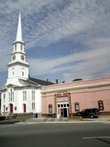
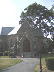
The bucolic setting of the site of Billings’ Tavern in Sharon is slowly being encroached upon by development as I related in entry #16. It does not help that Interstate 95 crosses the area at the Sharon/Foxborough line on the other side of the cranberry bogs. There is an exit ramp on Main Street, which I am obliged to cross, but the highway here is not quite the obstacle it has been in some parts of my journey as it is built into the side of a hill, and Main Street passes over it and has sidewalks. For two miles I walk through the town of Foxborough on Mechanic Street, with agreeable middle class neighborhoods in partially wooded settings, until I reach Foxborough Center. The town center is yet another pleasant iconic New England village, with white churches and small businesses, a large and well landscaped Common, and an unusually elegant Civil War Memorial which was used as the town library for a century. Most people know Foxborough as the home of the New England Patriots, who play in Gillette Stadium, on US route 1. The town center gives no indication whatsoever that there is a mammoth stadium relatively nearby, with huge parking lots and a burgeoning shopping complex adjacent to the stadium. Steady but light traffic circles the Common, people sit and chat on benches, and the bustling little library is well stocked and a refreshingly cool escape from the relentless summer sun and 90 degree heat.
The town of Foxborough was not officially established until 1778 and is comprised of pieces of Wrentham, Stoughton, and Stoughtanham (the remainder of which became Sharon a few years later). It was remote even by seventeenth-century standards; as late as 1730 there were only nine farms recorded in the area, although the Boston to Bristol stage passed through here as early as 1718, and Sarah Knight passed through in 1704, along the one road that existed in the area, the Country Road or Old Post Road or Old Roebuck Road.(1) Two miles past Foxborough Center, on South Street, was a tavern called Hewe’s, which is listed as being in Wrentham in the Vade Mecum of 1732, seven miles distant from Billings in what was then Stoughton. I measure it at five miles, but I don’t know what to make of the difference. A plaque tells me that this was the site of the tavern, and I know the site of Billings’ as well, so there really can be no explanation except that the almanac from 1732 is wrong.
Earlier maps of the area show only one house, in 1670 the house of one John Hudson and in 1704 referred to as Shephard’s Farm.(2) This house was located a mile farther down the road where it merges with Cedar Street and crosses over the Wading River. The house has one of Foxborough’s small claims to fame as the site of a meeting in 1670 of Squamaug, Sachem of the Ponkapoag tribe of Massachusett Indians, and Philip, or Metacom, Sachem of the Wampanoag Indians, to settle a land dispute. Both groups claimed territorial rights to the area that is now Foxborough and decided at this meeting to use the previously decided boundary line between the Massachusetts Bay Colony and the Plymouth Colony, which today marks the boundary between Norfolk and both Plymouth and Bristol Counties, as the boundary between the two territories. Foxborough is in Norfolk County, and the Foxborough line with Mansfield is the same boundary discussed in 1670.
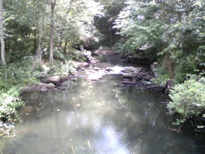
It is fitting that this line is here as there are various other indicators that we are leaving one territory and heading into another. The Neponset River has a tributary that starts near Gillette Stadium. The Neponset, which I crossed a number of times already, drains into Massachusetts Bay and is the southern boundary of the city of Boston. The Wading River, where I stand now, drains into the Taunton River which in turn drains into Narragansett Bay on the south coast of New England. Thus we have left the watershed of one river and entered that of another which faces south instead of east. Indian tribes of different language groups at the time of contact primarily occupied one watershed area. Thus the Massachusett Indians lived around Massachusetts Bay, while the Wampanoags principally occupied the drainage system of the eastern shore of Narragansett Bay.(3) Although all the Indians in northeastern North America spoke languages in the Algonkian family, different languages were spoken by different tribes. The nearest neighbors might understand most but not all of the adjacent tribe’s language, while more distant neighbors such as the Narragansett Indians of what is now southern Rhode Island would have had some difficulty understanding the MicMac of Northern Maine, New Brunswick, and Nova Scotia. In my mind I think of this in the same way I think of Latin: at some point all the subjects of the Roman Empire would have spoken Latin, but as time passed dialects emerged which over time crystallized into national languages such as French, Spanish, Portugese, or Italian. Indeed there are still dialects in Liguria in Italy, which sound very much like their nearest neighbor across the border, in this case Provence in the south of France. For instance my aunt says “fougassa” for the Italian bread widely known by the Italian word “focaccia,” while the bread is referred to in Nice as “fougasse.” Although I am no expert on languages, I have an idea this might be similar to the differences between the Algonkian spoken by Massachusett and Wampanoag.
The other frontier we have crossed as we enter North Attleborough is the colony line between the Massachusetts Bay Colony, the “Puritans” of John Winthrop and Cotton Mather, and the Plymouth Colony, the “Pilgrims” of Myles Standish and John Alden. Though most people arbitrarily mix the two, they differed significantly in their missions, philosophies, outlooks, and histories. The Pilgrims, for example, settled Plymouth ten years earlier than the settlement of Boston by Winthrop and his followers. The shifting allegiances of the two colonies with various Indian tribes in New England was to play an important role in the settlement pattern of the area, most significantly the colonization of Connecticut by Puritan settlers from Boston under John Winthrop Jr. As I make my way through this area, I will come back to the political and cultural differences between different groups of English settlers in Southern New England, and the geographical and political impact of these groups on the areas affected as we now know them.
*****
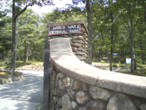
Clockwise from top left: 1. Foxborough Center, Congregational Church and Orpheum Theater. 2. Wading River, Foxborough, MA. 3. Memorial Hall, Foxborough, MA. 4. World War I Memorial Park, Mt Hope Hill, North Attleborough, MA.
One mile of hot walking after crossing the Wading River, on the edge of a street with no sidewalks, I cross into Plainville, and after another mile of walking in an unremarkable area, I turn left off of Route 106, which was Cedar Street in Foxborough and Messenger Street in Plainville, and continue on Messenger for a short distance before I ascend a fairly steep hill and enter North Attleborough. The street here is called Elmwood, and at the crest of the hill on the left I pass the pretty World War I Memorial Park on Mount Hope Hill. The road then goes downhill and at the bottom of the hill intersects with US Route 1, Route 1A, and North Washington Street at the north end of North Attleborough Center. I have closed the circle I started in Norwood when I decided to follow the routes of both Sarah Kemble Knight and Alexander Hamilton. From here the two routes converge and follow the same path to the falls at Pawtucket.
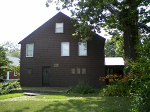
North Attleborough has a long history as an outpost of settlement. John Woodcock, the first settler in the area which was “purchased” from Wamsutta (4), Sachem of the Wampanoag in 1661, established a tavern in 1670 on his property, which was known as Woodcock’s Garrison. The Garrison was the scene of intense and brutal fighting in the 1670s. One of Woodcock’s sons was ambushed, and his head was placed on a pole near the Garrison. Woodcock himself was reprimanded by the courts for his atrocious behavior towards the Indians, in one case kidnapping the child of a neighbor in order to collect an unpaid bill.(5) The tavern itself is listed in the early almanacs as an important stop on the Post Road. Tulley in 1698 lists Woodcock’s as ten miles from Billings’. Woodcock’s house remains in North Attleborough today although this version of the house dates from the early eighteenth century. Woodcock himself died in 1701. By 1744 the traveler to what was originally part of the town of Rehoboth but was by then called Attleborough, was stopping at what was called Slack’s Tavern. Hamilton “lay that night at one Slake’s” on July 17, 1744, (6) and James Birket, who traveled through America in 1750, visited “Mother Stack’s, who I thought realy very Slack in her Attendance...” (7) The tavern apparently was in service from 1670-1840, as it also lay by that time on the Boston Turnpike and continued to see traffic until the arrival of the railroad.
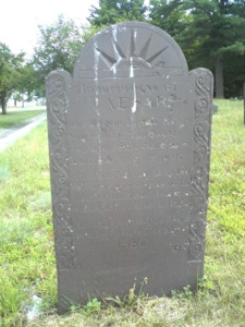
Across the street from the Woodcock Garrison House is the small Woodcock Historical Burial Ground from 1676, where family members slain in King Philip’s War were laid to rest. One gravestone that caught my eye is that of “Caeser” a slave. The caption on the gravestone is very intriguing (see photo below).
I continue down Washington Street through bustling North Attleborough Center and, after two miles of walking in a driving thunderstorm, reach a junction with US Route 1. Just beyond the junction a road veers left, Old Post Road. Well, that was easy. I follow Old Post Road, which is surprisingly busy, until I see a sign indicating we are entering “Old Towne Historic District.” With the exception of the Congregational Church, there is virtually nothing old about it, although the names of the brand new housing developments would have you believe otherwise. One particularly egregious example of chutzpah is the inaptly named “Olde Towne” residential complex on “Historical Way.” Except for some of the rock foundation upon which the houses are built there is absolutely nothing “olde” or “historical” about this development.
Two miles walk, passing under Interstate 95 for the fourth or fifth time on my trip, I cross into Attleboro and more of the same: shockingly ugly developments in the midst of some quite beautiful farmland and streams and ponds. One house, which I did not take a picture of for fear of my personal safety, resembled nothing if not an even uglier version of Tony Soprano’s house, replete with a Bentley in the driveway. After a mile, the Old Post Road, merges with Newport Avenue. At this junction I have two choices: I can turn right onto Newport Avenue and follow it for a mile then turn south onto Route 1A, a busy road with lots of shopping malls, or turn left then right onto Reade Street and follow that road to Cottage Street where I turn right and meet Route 1A a mile farther along. Both routes get me to the same place, at the Attleborough/ Pawtucket line, but the second is quieter, so I opt for Reade Street. This turns out to be a mixed blessing. While there are a number of pretty farms, there is also a lot of new development and, worst of all, Cottage Street has a bridge that crosses the MBTA railroad tracks which is under repair and is closed, which necessitates a slog through a shopping mall parking lot to reach the junction of Route 1A and Cottage Street. On the way, at Newport Avenue and Reade Street, is Newell’s Cemetery, established in 1715. As there is a tavern listed in 1797 in Attleborough called Newell’s, nine miles from Providence, this was probably roughly the location of said tavern.
*****
Clockwise from top left:
1. Woodcock Garrison House, North Attleborough, MA, c. 1730.
2. Grave stone of “Caeser,” caption reads : “In Memory of CAESER
Here lies the best of slaves now turning into dust;
Caeser the Ethiopian craves a place among the just.
His faithful soul has fled to realms of heavenly light,
And by the blood Jesus shed is changed from black to white.
January 15 he quitted the stage
In the 77th year of his age. 1780”
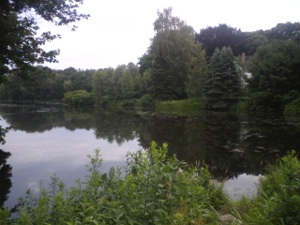
3.Pond at Seven Mile River, Old Post Road, North Attleborough.
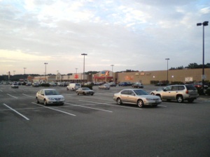
4.Shopping Mall at US Route 1 near County Street South Attleboro, MA.
5.Farm and cow rear end at Reade Street Attleboro, MA.
6.Old Post Road at US Route 1, North Attleborough, MA.
Cottage Street at US Route 1 is located in Pawtucket, Rhode Island. I am officially no longer in Massachusetts and have crossed into a new state for the first time. This section of Pawtucket, east of the Blackstone River, was originally part of Rehoboth, Massachussetts and did not become part of Rhode Island until 1862. I was shocked to discover that New England states were still sorting out their borders almost a century after the Revolution. East Pawtucket is very busy and built up. It is clear I am in the outlying area of a large urban agglomeration as I continue down Cottage Street, turn left onto Bend Street, and right onto Walcott Street to reach Main Street, which curves slightly as it approaches the bridge that crosses the Blackstone River, the boundary between Massachusetts and Rhode Island in colonial America. I have reached the final frontier of the day, the end of the Massachusetts portion of my journey. After twenty miles of walking today, I will take a little time to reflect on the part of the journey I have completed and plan for the next phase of this journey.
Monday, July 5, 2010

Walking the Post Road
Falls at Pawtucket on Blackstone River, formerly the boundary between the Massachusetts and Rhode Island colonies. A bridge was built across the Falls in 1713. An early site for mills that powered the Industrial Revolution in America.
Notes
-
1.Jack Authelet, Images of America: Foxborough, Massachusetts (Boston, 2001), 1.
-
2.Clifford Lane, This Was Foxborough (Foxborough, 1966), 10.
-
3. Neal Salisbury, Manitou and Providence: Indians, Europeans, and the Making of New England, 1500-1643 (New York: Oxford University Press, 1982), 19-21, passim.
-
4.Wamsutta was the eldest son of Massasoit, Sachem of the Wampanoag at the time of the establishment of Plymouth Colony. He was the brother of Philip (Metacom). Wamsutta served as Sachem of the Wampanoag, or Pokanoket from 1660, when his father died, to 1662, when he died under mysterious circumstances in Plymouth, and was succeeded by his brother Philip. Philip ruled as Sachem until his murder in 1676 by a posse of English settlers near Mount Hope in Bristol, Rhode Island.
-
5.John Daggett, Sketch of the History of North Attleborough (Boston: Samuel Usher, 1894), 109.
-
6.Alexander Hamilton, Itinerarium, 104.
-
7.Birket, Some Cursory Remarks, 25.
“John Woodcock is allowed by the Court to keep an Ordinary at Ten Miles River (so called) which is in the way from Rehoboth to the Bay; and likewise enjoined to keep good order, that no unruliness or ribaldry be permitted there.”
July 5, 1670.
From Colonial Records, cited by John Daggett, in Sketch of the History of Attleborough (1894), p.90
