Entry #51: Mile 210, Westport, Connecticut. Gold Coast.

Samuel Penfield was the innkeeper of what was known as the Sun Tavern in Fairfield, from at least as early as 1750, until his death a half century later in 1811. On Christopher Colles’s map of the road from New York to Stratford, Connecticut, Penfield’s Tavern is clearly labelled in the center of Fairfield, behind the Town House and opposite the “Presbyterian” church, next to a small pond on Fairfield Green. Benjamin Low lists Penfield’s tavern in Fairfield in his 1790 list of taverns, and on the morning of October 11, 1750, James Birket “breakfasted at one Penfield’s & had chocolate and plenty of toast.”(1) A long and illustrious career indeed for an innkeeper (George Washington stopped in Fairfield, but his diary does not mention the tavern’s name or the owner, although local histories of Fairfield claim it was Penfield’s), and an even longer life for the actual building which still sits in the same location, behind the town hall and near the church on the town green in Fairfield. The tavern was burned down by British troops in 1779 but Samuel Penfield rebuilt the tavern in 1784 and the building remains in the same place today, part of and adjacent to the Fairfield Museum and History Center, probably the best museum dedicated to a town this size I have ever visited. Within its brand new but harmoniously designed building are well-designed displays covering the history of this small but important Connecticut town from precolonial times to the present, including, at the time of my visit, a history of baseball in the Bridgeport/Fairfield area. The Museum also has an excellent research library and a knowledgeable and helpful staff, including the librarian Rod Mackenzie, who enthusiastically assisted me on short notice, pulling out all manner of articles and photographs that connected Fairfield to the Post Road. He even was able to help confirm that Colles’s map was indeed accurate about one specific point: the view from the research library takes in the green and the Sun Tavern, and on Colles’s map there was a small pond to the west of the tavern. I asked whether there was ever a pond on the green, and Mr. MacKenzie pointed out the depressed area just west of the tavern and told me they had drained the pond some years back, but the depression was still visible. Indeed the photograph above was taken by me as I stood in the depression that was once a pond adjacent to the Sun Tavern.
*****

In the last entry I discussed the rate of travel over the last few centuries. Using the tavern lists I can gauge how much ground a traveler would be expected to cover in one day by examining the distances between taverns. Often there are taverns that go unmentioned by the almanac writers, perhaps because they did not pay to be listed, perhaps because the author thought that they were of substandard quality, or perhaps out of ignorance of the route as many writers never actually traveled the route and merely “borrowed” the information from other almanacs. However, there is almost always a tavern every 4 to 10 miles, indicating that such a distance would not be difficult to cover before a break was required or desired.
For reasons unknown to me, the longest gap between taverns from the earliest list in the almanac of John Tulley in the late 1690s, through Thomas Prince’s almanac of 1732, and continuing to Benjamin Low’s almanac of 1790 is the twelve miles listed between Fairfield and Norwalk. No other portion of the road has a gap of more than ten miles in New England on any tavern list. For a densely populated area such as Fairfield County in Connecticut, this seems surprising to me. As it turns out, the stretch of road from the edge of Fairfield, through the Southport section of town, across the town of Westport, and into the City of Norwalk, is remarkably rural in character, and there is an abundance of colonial era houses, farms, streams, churches, and old cemeteries that remind me of the beautiful stretches of the walk I did in the Shore Line towns and in southern Rhode Island.
James Birket in 1750 specifically tells us “from Fairfield to Norwalk is 12 miles,”(2) and Hamilton mentions only crossing the Saugatuck River and that “the roads between this town and Norwalk are exceeding rough and stonny” and that “there is a river on the west side of this town which runs into the Sound. I forded it att high water when pritty deep.”(3) Sarah Knight mentions but little the trip between Fairfield and “Norowalk” saying only that “early the next morning we set forward to Norowalk, from its halfe Indian name North-Walk, when about twelve noon we arrived.” (4) On her return trip she mentions only “Having Ridd thro a difficult River, wee come to Fairfield.”(5) President George Washington also specifically tells us in his record of the trip he took from New York in 1789 that “From hence (Norwalk) to Fairfield, whence we dined and lodged, is 12 miles; and part of it very rough Road, but not equal to that thro’ Horse Neck (Greenwich). The superb landscape, however, which is to be seen from the meeting house of the latter is a rich regalia. We found all the farmers busily employed in gathering, grinding, and expressing the Juice of their apples; the crop of which they say is rather above mediocrity.”(6) A little later he notes that “the Destructive evidences of British cruelty are yet visible in both Norwalk and Fairfield; as there are the chimneys of many burnt houses standing in them yet.” (7) Hugh Findlay, postal surveyor, also mentions his visit to Fairfield in 1773-4, recommending that the town receive a post office, then proceeding “next day, twelve miles, on stoney broken ground to Norwalk.”(8) Thus, most of our travelers are precise about the distance from Fairfield to Norwalk and about the quality of the roads, but are mostly mute about the scenery with the description by Washington perhaps the most clear and the most poignant exception.
Of the inhabitants of the town of Fairfield itself, Madame Knight applied her usual acerbic wit to describe her impressions: “They have an abundance of sheep, whose very Dung brings them great gain, with part of which they pay their Parsons sallery, And they grudge that, prefering their Dung before their minister.”(9) There is little evidence of dung today in Fairfield, and plenty of evidence that the town is one of the more well-heeled pockets of America. The main street, Post Road (US1), is lined with high-end clothing stores, fancy restaurants, art galleries, and other signs of affluence notably absent from Bridgeport. Even Sarah Knight enjoyed her meal and lodging in Fairfield, a testament to the quality of the commercial establishments of Fairfield as far back as 1704, commenting that “wee come to Fairfield and wee Baited and were much refreshed as well with the Good things which gratified our appetites as the time took to rest our wearied limbs, wch I later employed in enquiring concerning the Town and the manners of the people &c. This is a considerable town and filled as they say, with wealthy people...”(10) before reverting to form as I mentioned above, and finding fault with the “Litigious” townspeople.
In addition to the visual evidence I have as I stroll down Post Road, the data backs up the assertion that Fairfield appears to be a nice place to live: per capita income of $44,000 (the highest of any town through which I have passed thus far), a very low crime rate (3 murders in five years, while Bridgeport had 3 murders a day some days in recent years), a great library (which indicates the schools are probably pretty nice as well). On the other hand, the 1975 film The Stepford Wives was filmed here, which to some probably makes it an even more desirable place to live.
The town of Fairfield today holds about 58,000 people, a small and tranquil town relative to its neighbors Bridgeport and Stamford. However in 1670 the town held 539 inhabitants, enough to hold the #5 spot in the list of largest towns in Connecticut, and even moved up to #4 by 1756 with 4455 inhabitants. The town then fell to #11 in 1774 with 4863, and took a long time to recover from being put to the torch by British troops in 1779. In 1910 Fairfield had barely more than 6,000 inhabitants, but the rise of the automobile and the infrastructure that accompanied it corresponded with a tenfold rise in the population of Fairfield in the last century, and it has become one of the prominent bedroom communities of New York owing to its relatively short distance from the city.
*****
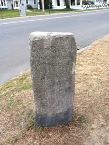
I leave the warm and friendly confines of the Fairfield Museum and head back out on to the road in search of lunch. I have walked from Stratford, Connecticut to this point in one morning and am now ready to sit down for a big meal before I continue on across the mysterious lands that make up the twelve miles between Fairfield and Norwalk. I continue down Old Post Road, and after only a couple of blocks the road turns sharply right. On the corner I find a milestone “reset” in 1855, which corresponds to the 63 mile mark on the Colles map. Old Post Road continues for one block until I reach the main street of Fairfield, Post Road. On the corner of Old Post Road and Post Road sits the Old Post Tavern at 1418 Post Road. There has never been a more appropriate moment for me to stop and eat a meal on this entire trip. Considering the name and location of this restaurant, I would be remiss NOT to eat here, so in I go. The food is excellent and the atmosphere is comfortable, albeit slightly more high-end than the places I normally frequent.
After a satisfying lunch and a couple of local brews, I head back into the winter cold and head west on Post Road and then turn right onto Mill Plain Road to continue north to the “Fording Place” on the Mill River, somewhat north of the current main crossing of Post Road. I cross under the railroad tracks and a short distance later find another milestone. This one is a little different because it indicates “1 mile to FF” (Fairfield) rather than the distance to New Haven. As we are almost 25 miles from New Haven, it seems I am finally leaving the New Haven orbit and turning my sites to Stamford, Greenwich, and the New York border.
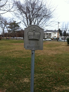
As I leave the center of Fairfield the landscape becomes more rural with woods, more green spaces, older colonial houses, and the lovely Mill River appearing on my left after I cross under interstate 95. A map drawn by Arthur Huntington that I studied at the Fairfield Museum recreates the Old Post Road using the roads of Fairfield as they were in 1935, which is immensely helpful to me. Huntington shows the old road continuing up Mill Plain Road until it reaches Mill Plain Green, where the road branches left onto Sturges Road, then forks left again onto Unqowa Road, where the traveler of the eighteenth century forded the Mill River at a shallow point here. Today there is a bridge further up the river which I am obliged to cross, as I am not particularly interested in attempting to cross the river by foot. A helpful King’s Highway marker on Mill Plain Road near Mill Plain Green also helps direct me along the old route. When it reaches the riverside park Unqowa Road veers right and, after walking down to the river to reach the old Fording Place, I continue up the road and over the river via the bridge to rejoin the old King’s Highway on Bronson Road. A series of stones at the junctions of the various roads seem to indicate the route the traveler should follow. One stone is just about at the site of the 62 mile mark on the Colles map.
I follow Bronson Road south along the west bank of the river until I reach Interstate 95 again, after which I pass the Penfield shopping center and turn onto King’s Drive for a few yards. Then I am obliged to turn left and then right onto Post Road (US1) again. This time the experience on US1 is very unpleasant; there is no sidewalk and the road has no shoulder. I carefully tread along the edge of a steep embankment on the other side of the metal barrier running along the edge of the road. I slip once or twice and almost fall down the slope, which is very unsettling, but make it through the next few yards with no permanent damage. Next I cross under interstate 95 once more, after which I have to run across four lanes of traffic of US1 and jump a center barrier to reach King’s Highway. The last few minutes have been very unpleasant and dangerous but I finally get through the busy area to reach the more tranquil road. I get a breather for a few minutes until King’s Highway crosses busy Boston Road again. After I cross this road for the final time in Fairfield, I am again on King’s Highway and pass two colonial houses, including one built in 1755 by Stephen Osborne. Colles shows a tavern run by Osborne at about this spot on his 1789 map, just before a small creek with a mill. Soon I reach the very creek shown by Colles, and enter the town of Westport, which is made up of areas that originally were part of Fairfield and Norwalk.
*****
Fairfield, Connecticut. Top left is the Old Post Tavern, 1418 Post Road at the intersection with Old Post Road. Great food and the perfect place to eat considering the name and location of the restaurant. Top right is a stone on Old Post Road that was reset in 1855 and corresponds to the place marked Mile 63 on Colles’s map. Middle left is a photograph of the site of the old fording place on the Mill River marked on Colles’s map and described by Hamilton, Birket, Knight, and others. Top right is a milestone on Mill Plain Road indicating one mile to FF (Fairfield). Bottom right is the Osborne house from 1755, roughly at the location of Osborne’s tavern shown on the 1789 map of Christopher Colles, near mile 60. Note the King’s Highway sign in front of Osborne’s and another one pictured at bottom left on Mill Plain Green, both marking the route of the original road through Fairfield to New York.
Westport is a quintessential Gold Coast town, as the per capita income of $73,644 (2007 figure) ranks it behind only Greenwich and Darien amongst the towns along the route of the old post road from Boston to New York. Newport may have had its day in the sun but the REAL money is here in Fairfield County, Connecticut, where three of the top five wealthiest towns in America are found. New Englanders not being ones to flaunt their cash, it is not an ostentatious town, just a really, really nice town where everything seems to run smoothly, where the houses are all well kept, and where the Historical Society receives support from the Newman Foundation, started by a famous local family who dabbled in popcorn and salad dressing. Indeed the day I arrive in Westport there is fortuitously an exhibit at the Historical Society devoted to historical maps of Westport, which of course is of great interest to me. The lovely staff are very helpful to me in spite of the oddity of my pursuit and the excessive enthusiasm I demonstrate for the exhibit on display.
The Westport Historical Society is located in the center of the village of Westport, on the Saugatuck River. This river is mentioned by Hamilton, who forded the river at low tide and dined at “one Taylor’s..an old man of 70.”(11) This is the only reference to the area I have found in the various travel reports I have examined. Alexander Hamilton was a medical doctor and was often consulted for advice by the people he encountered on his travels. This particular instance was one of the more moving descriptions of the limitations of medicine: “He (Taylor) understanding from my boy that I was a doctor from Maryland and having heard that some doctors there were wonders in the practice, he asked my advice about a cancer which he had in his lip. I told him there was once one Bouchelle in Maryland who pretended to cure every disease by the help of a certain water which he made, but as for my part, I knew of no way of curing a cancer but by extirpation or cutting it out.” Pretty much what happens today.
The Saugatuck River crossing in Westport village, which was accomplished by a bridge by the time Colles drew his map in 1789, is near the 55 mile mark on Colles’s map, while the creek that today marks the boundary between Fairfield and Westport is between mile 60 and 61, five miles away to the east. This part of Colles’s map is one of the few areas where I have difficulty sorting out the exact route. I am not sure whether it is me or the map, but it seems clear to me that Osborne’s on King’s Highway today is the same Osborne’s as the one shown on Colles’s map and that the crossing of the river is also the same as it is on the map, but the angle of the road on Colles’s map does not quite work. I find one or two clues along the way that clarify portions of the road, but ultimately I feel as though I am not walking the precise route on Colles’s map, and I can find no solution from the maps on display at the Historical Society either.
The first section of the walk is clear enough: continue on King’s Highway where it changes name to Green Farms Road. Colles shows a “Burying Ground” on his map a little past mile 58 so I hope to find one myself and am not disappointed as I find a colonial cemetery about 2.4 miles along Green Farms Road. My suspicion is, however, that following Green Farms Road the whole way is too roundabout a way to get to the cemetery and is at least a quarter mile too long, so I opt to follow Clapboard Hill Road which seems to resemble the twists and turns on Colles’s maps more accurately. I do find one house dating from 1727 very soon after I start down Clapboard Hill Road which makes me feel that I am not too far off the mark in my assumption. The other houses along this road lead me to believe there is some serious money on Clapboard Hill. After ten minutes Clapboard Hill Road rejoins Green Farms Road, and I pass some beautiful farm land, then I cross a creek which is marked on Colles’s map. According to Colles, there was a house owned by a Ripley near the creek. One of the maps at the exhibit shows the house of minister Hezekiah Ripley near the “fording place,” the spot where I stand here on Green Farms Road next to the creek. Just ahead of me was once a colonial church which is no more, but the cemetery remains, and thus I feel satisfied I have stayed on course thus far. A marker at the cemetery indicates that I am on the “Jennings Trail” (not sure what that is), that this cemetery dates from 1725, and that across the street stood the Second Green Farm Meeting House, circa 1740, burned 1779 in Tryon’s Raid. This would explain why there is no church on Colles’s map even though the church is on a 1766 map of Connecticut.
From here the road is a little confusing. I need to get to Westport village which would require me to head northwest from here but Colles’s route heads in a westerly direction instead. The only solution is to head up Prospect Road to reach Spicer Road, which I do in spite of the fact that it clearly is not the exact route. Where the original road ran in this mile long stretch is a mystery to me but upon reaching Spicer Road I feel confident that I have regained the old road. On the older maps of Westport in the exhibit Spicer Road is called Hillandale Road, and on at least one map from before 1835 “Pequot Trail or Highway.” On the map from 1835, hand drawn by Irving Putney, the “Highway” runs into the “Turnpike,” which is today’s US1, or Post Road, and dates from 1800, just about where East Main Street meets Post Road today. Unfortunately for me Spicer Road stops short of Post Road, but I notice a gap in some trees, leave the road and cut across into a parking behind some buildings on Post Road. I follow the drive leading into the parking lot and it takes me to Post Road. Subsequent examination of older maps indicates that there was once a road that ran right through this parking lot but that it was eliminated in the recent past and replaced by a parking lot.
I am back on Post Road for a half mile. I cross Compo Road, which leads to the beach where British troops landed before burning most everything of value in this area in 1779. To reach the bridge across the Saugatuck I take Myrtle Avenue, which skirts the edge of the village and passes by the Historical Society I mentioned earlier (well worth a visit when in Westport). On the grounds of the Episcopal Church nearby is a plaque that mentions the Disbrow Tavern and that Washington stopped there in 1775 on his way to Boston. At Main Street, Myrtle changes name and the road becomes King’s Highway North. On Colles’s map of 1789 the road crosses a creek just before crossing the Saugatuck River. This road has the same layout and I cross over a small bridge across a small creek before reaching the bridge over the Saugatuck River, which is quite a large river especially to the south, where it widens to considerably more than one hundred yards.
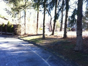
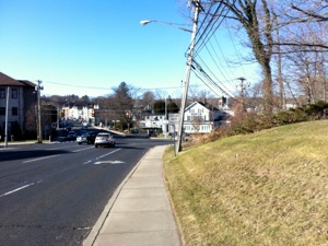
The King’s Highway through Westport Connecticut. Top left is a bucolic stretch of Green Farms Road. Green Farms was the name of the area on a map of 1766 and was annexed to the newly formed town of Westport in 1842, from Fairfield. Top right: I tried to follow the old route near Spicer Road in Westport, which required passing through a parking lot and cutting through some trees to reach Post Road. The old road once continued through the trees to connect with Spicer Road on the other side. Bottom left is a view of Post Road (US1) heading into the village of Westport, which sits on the east bank of the Saugatuck River. Bottom right is the Westport Historical Society in a building from 1795 renovated in the nineteenth century in Italianate style.
The last three miles into the historic center of Norwalk are enjoyable because it becomes a treasure hunt: Colles’s map is particularly accurate in this area and there are many pieces of evidence to help me find the original route. King’s Highway heads southwest sharply after crossing the Saugatuck River, which Hamilton forded but which was crossed by a bridge built shortly after Hamilton’s visit and shown on Colles’s map. A succession of eighteenth-century houses line this hilly stretch of road. At a junction with Old Hill Road is the Lieutenant John Taylor House from 1711 and a plaque that says the area was once known as Taylortown. Colles shows a Taylor’s tavern further to the south, and Hamilton stopped at the elderly Taylor’s as I described above. Colles lists a house owned by a Wright and I indeed find a Wright house from 1760 near Wright Street a little further on. I find the Nash house from c.1730 at the crest of a hill that leads down to a creek, marked on Colles’s map as having a mill. This creek has a little waterfall which leads me to believe there was a mill here as any sane eighteenth-century New Englander was not going to let the potential power to be derived from the water here go to waste. George Washington “dined and lodged at one Marvin’s, 9 miles further (from Fairfield); which is not a good house, though the people of it were disposed to do all they could to accommodate me.”(12) This tavern is shown on Colles’s map at the 54 mile mark, just a few yards past “Nash’s creek”, or “Mill creek” (why not?) and, surprisingly, very near Taylor’s tavern. Was there really that much traffic in this short stretch that two taverns would set up directly across the street from each other?
All in all I have a great deal of success finding landmarks and houses listed on maps and in diaries. The only houses I fail to find are Lucy and Ricky Ricardo’s and the Stephens’s residence, home of Darrin and Samantha of Bewitched fame; both families “lived” in Westport in the 1950s and 1960s.
Soon I reach Post Road again, which I walk along for about five minutes before I cross the road where King’s Highway south leads away from the main road, skirting the western edge of the Birchwood Country Club. A little further on is the John Platt House from 1750, exactly in the spot where Colles has a house owned by Platt marked. A plaque on the side of the road indicates that “this house stood facing the King’s Highway, the principal highway between New York and Boston.” Soon I reach the Norwalk line and the name of the road changes to County Street. The road is winding and gently hilly as it continues through residential neighborhoods dotted with the occasional colonial-era house. I pass Norwalk High School and a lovely marsh, but soon the tranquility of County Street ends as I reach the final stretch of road into Norwalk, which follows US 1, called Westport Avenue here in Norwalk.
A long walk downhill then uphill along the busy street brings me to the top of a hill after which Westport Avenue heads straight downhill into the center of Norwalk. At the bottom of the hill I turn left onto East Avenue and in a minute reach Norwalk Green, flanked by two churches, one Congregational and one Episcopal, as shown on Colles’s map. Betts tavern on Colles’s map is not to be found, but the friendly staff at the Norwalk Inn and Conference Center welcome me in to their warm confines. A welcome relief after a very long days’s walk. I have crossed the mysterious lands between the Sun Tavern in Fairfield and Belden’s Tavern in Norwalk. Only seventeen miles to the New York line through more Gold Coast towns. I wonder what Madame Knight made of these towns...
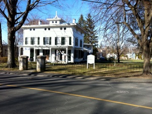
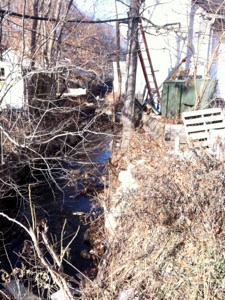
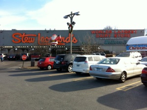
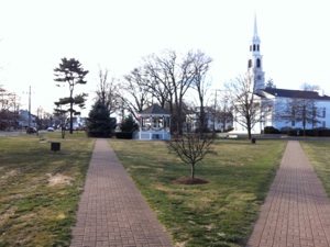
Westport to Norwalk : Top left is the small creek on King’s Highway North near the Nash house which is on Colles’s map as well. Top right is the intersection of Post Road West and King’s Highway North in Westport. Bottom left is Stew Leonard’s, self-proclaimed “World’s Largest Dairy Store,” on Westport Avenue in Norwalk Connecticut. It seems like a grocery store or a big Trader Joe’s to me but who can argue with Ripley’s Believe it or Not? Bottom right is the view south of Norwalk Green from the front of the Episcopal Church. The Congregational Church is to the right just about where Colles has it on his 1789 map.
Tuesday, January 18, 2011

Walking the Post Road
The Sun Tavern, Fairfield, Connecticut.
“This is a considerable town and filled as they say with wealthy people.”
Sarah Kemble Knight, December 23, 1704, commenting on the town of Fairfield in The Journal of Madame Knight, 72.
Distance Walked in the Entry: 12.45 miles
Total Distance Walked in Connecticut: 124.78 miles
Total Distance Walked for this Project (from Boston): 295.4 miles
Distance Remaining to New York: 52 miles
Notes
-
1.James Birket, Some Cursory Remarks, 38.
-
2.Ibid.
-
3. Alexander Hamilton, Some Cursory Remarks, 167.
-
4.Sarah Knight, Journal, 67.
-
5.Ibid., 72.
-
6.George Washington, Diary, 21.
-
7.Ibid.
-
8.Hugh Findlay, Diary, 44.
-
9.Knight, 72.
-
10. Ibid.
-
11. Hamilton, 167.
-
12. Washington, 52.

