Entry #48: Mile 194, Stratford, Connecticut. Colle-ating Stones.

From where I stand in Stratford, Connecticut I am 14 miles from New Haven, and there are precisely 73 miles remaining to reach Federal Hall in Lower Manhattan. I know this because I have found the “Rosetta Stone” that allows me to recreate the road in its entirety from this point on as it ran in 1789. I have used local histories, diaries of earlier travelers along the old post road from New York to Boston, careful study of maps, and intuition to figure out the road thus far. Now I have an explicit guide to the road in front of me thanks to the heroic efforts of the surveyor Christopher Colles, who in 1789 embarked upon a project to map out all the roads in the country and compile an atlas to display his maps in a strip style, with approximately 12 miles of road on each plate. Below is a copy of the final strip of the road from New York to Stratford.
Unfortunately, subscriptions to his atlas were insufficient to support this project, which he abandoned in 1792, having mapped about 1,000 miles of roads from Williamsburg, Virginia as far north as Albany, New York and as far northeast as Stratford, Connecticut. On the other hand, the maps he did leave behind are of a very high quality and indicate the locations of churches, taverns, the houses of prominent citizens, and blacksmith shops. The maps also mark off the miles to New York along the road, and, as Colles was a surveyor, the maps are drawn to scale unlike many maps of the time, which makes the calculations of distances on the map straightforward. The map is a goldmine of information about the road as it existed in 1789 and will be my guide for the remainder of this trip. Certainly changes in the road occurred between the time the first English settlers showed up in the 1630s and the time Colles produced the maps of the road, but the maps do predate the turnpike era and thus present a portrait of the road at the dawn of the new republic and prior to the reconstruction of many sections of the route from Boston to New York that ensued in the following decades.
Additionally, I am fortunate that I am now able to dip into the diaries of two other travelers who passed along this stretch of the road to augment the commentary I have already referenced from the earlier travelers Alexander Hamilton, James Birket, and the inimitable Madam Sarah Kemble Knight. A French lawyer, Jean-Pierrre Brissot de Warville, traveled through the United States in 1788 and published an account of his travels which is highly informative as well as interesting to read.(1) And none other than President George Washington traveled to Boston through Connecticut as part of a celebration of his inauguration in 1789. President Washington, true to his reputation, left us with a sober and detailed account of this trip, including commentary on the quality of the inns and taverns at which he stopped. Both of these journeys conveniently occurred at virtually the same time that Colles was putting together his atlas, thus allowing me to directly compare the statements made by his illustrious contemporaries with the facts he recorded in his maps.
Another source that will be of great use to me in this last phase of the project are the tavern lists from the almanac produced annually by Nathanael Low from the early 1760s to about 1800. The names of the taverns from Boston to New York and other points are listed along with the distances in miles between taverns. Over the course of forty years the names of many of the taverns recorded in Low’s almanac changed with some regularity, and thus having a record of the owners of the taverns in the towns along the route for four decades will be very helpful in piecing together the clues I glean from all of these sources.
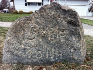
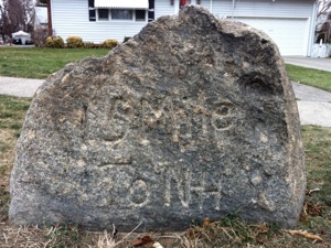
And finally, the heroic efforts of Henry P. Sage, who spent the decade from 1922-1931 tracking down, photographing, and describing all the milestones he could find in Connecticut will prove to be one of the single most valuable resources I have acquired, thanks to the help I received from the curator at the New Haven Museum, James Campbell. Because of the descriptions by Sage of the stones he found on the road from New Haven to Fairfield, I have been able to take Colles map and find a specific point that corresponds to contemporary maps. From the stone next to me here in Stratford, (pictured above) to which I was directed by Sage’s earlier efforts, I discover that the milestone corresponds almost exactly with the 73 mile mark recorded by Colles on page number seven of his strip map “From New York to Stratford,” (see below) and thus can now use Colles’s maps to figure out much more accurately the exact route a traveler such as President Washington would have taken in 1789. In short, I have enough data to keep me very busy on the final 73 miles of the trip.

At left is the Stratford section of Christopher Colles’s 1789 map of the road from New York to Stratford. Just above the creek on the map is a dot labeled 73, indicating the distance to New York. This spot is also the location of a milestone, pictured above in a photograph from the 1920s, indicating the distance to New Haven. The same stone can be seen today (at the top of the page, partially buried) in the same spot, just off East Broadway Street in Stratford, a few yards away from a creek, presumably the one recorded by Colles.
The Google map above illustrates a number of points I wish to make about the direction of this project from here to New York. The red line is a map of the route from the Washington Bridge on the Housatonic River to the milestone on East Broadway (#14). This distance is about three quarters of a mile, which corresponds precisely with the distance Colles gives from the milestone near the creek to the ferry landing on the Housatonic River, the approximate site of the Washington Bridge which replaced the ferry in 1802. The street today is called Ferry Boulevard, and the distance from the milestone to New Haven is in fact about 14 miles, following the original roads as closely as possible.
Additionally the angle from the bridge to the milestone is about 225° (i.e. Southwest) while on Colles’s map the line from the ferry landing to the 73 mile mark at the creek is 220° (also SW). The road on Colles’s map then curves sharply west, enters the center of Stratford, passes through the town and heads west (actually slightly northwest) to reach the 72 mile mark. A similar pattern is found on the modern map above which I have outlined in green. A sharp curve is followed by a turn down Elm Street and then another turn on Broad Street, which heads west out of the center of Stratford and turns slightly northwest as it heads uphill. By Colles’s map, I would expect to find a milestone shortly after crossing California Street. Sage tells us that the “Number Fifteen” milestone, a “solid gray marker may easily be found on the north side of the old highway which leads northwesterly from Stratford’s Main Street, under the railway, to and across Barnum Avenue. It stands in a small park about midway between the railroad underpass and said avenue.”(2) The stone is exactly where Sage said it would be as I have indicated on the map (red pin). The blue pin nearby marks the site I would have predicted the stone to be based on Colles’s map. The difference is 700 feet, which is about 140 Roman footsteps away from the present site of the stone. As the stone is in a park, it is entirely likely that it was moved there at some point when a construction project may have forced its relocation. Fortunately it still exists, unlike so many other milestones that have disappeared.
The next stone would be located a few yards past a creek that the old road crosses about a mile due west of the 72 (or #15, depending on your orientation to New York or to New Haven) milestone. Following Colles’s map the road passes over a brook, today’s Mill Brook, the present border between Stratford and Bridgeport, which is reached by following Barnum Avenue then turning right onto Boston Avenue which diverges from Barnum Avenue and continues in a westerly direction. As you can see the next mile on the above map does exactly that-- it heads northwest, then in a westerly direction, crossing a creek (Mill Brook) a mile from the previous spot at what is today Boston Avenue (US1) and Weber Avenue.
The final milestone is described by Sage as being on ‘Old Mill Green’ in Bridgeport. I use a combination of Colles’s map, Google maps, and Sage’s description to find the next milestone, which is about one mile further on, squarely in the center of Old Mill Green, exactly where it should be. You can see that map in the next entry that I post on Bridgeport, but you get the idea-- this correlation of milestones, Colles’s map, and current technology, including Google maps, has shown me the way to map the route as accurately as possible for the contemporary traveler who might be interested in knowing which way his predecessors journeyed.
*****
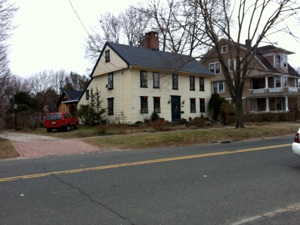
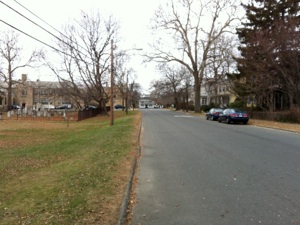
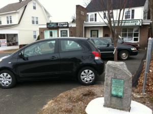
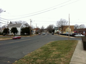
Stratford, Connecticut, clockwise from top left: 1. Historic markers conveniently placed in the town of Stratford by the Daughters of the American Revolution in 1915, direct me along the King’s Highway through the town. This marker is at the corner of East Broadway and Elm Street, and directs me down Elm Street to Broad Street, just as Colles’s map illustrates. 2. Eighteenth-century house near the marker on Elm Street. 3. The view west on Broad Street from Elm Street. 4. “15 miles to NH” Milestone o Broad Street west of the railroad tracks, exactly where Sage said it would be and just about a mile from the previous stone.
I entered “New York” sometime yesterday. The incidence of Yankee paraphernalia has dramatically increased, and I see many signs, bumper stickers, flags, jackets, and ball caps for the New York Football Giants as well. Accents are becoming more noticeable, especially in restaurants where I overhear conversations and engage people in conversation. And I saw the “New Jersey Housewives” yesterday, or at least three women who worship at their altar, “tawking” in a restaurant in Stratford. People just do not dress or look like that in New England.
Stratford is a nice town, but it is not as well-to-do as some of the towns I have visited. Perhaps it is the proximity to Bridgeport, or perhaps this is what Fairfield County is like compared to the Shoreline towns, but it has a slightly grittier feel than even Milford. Having said that, it is a very pretty town in places, especially in the historic district in the center of town around the Elm Street, Broad Street junction. The streets in this area are lined with colonial era houses, and Main Street has a typical New England aspect.
Including the walk from Washington Bridge over the Housatonic river I actually walk only about two and a half miles in Stratford before crossing into Bridgeport, which was originally part of Stratford. A town of almost 50,000 inhabitants, Stratford has a demographic makeup that makes it a most typical Connecticut town on average: about 70% White Non-Hispanic, 11% Black Non-Hispanic, 13% Black, and 3% Asian with mixed race making up the remainder. This is roughly the breakdown of Connecticut, although as we have seen and shall see, the distribution is not always as even as it is in Stratford. Towns to the east of New Haven typically are more than 90% White, while New Haven and Bridgeport have majority minority populations, but Stratford has a fair mix of populations of all races and ethnicities that is increasingly becoming the face of America.
*****
Washington visited Stratford on his grand tour of Boston and the “Eastern States” in 1789 (he avoided Rhode Island as they had not yet ratified the Constitution and hence were not technically an American state yet). After leaving New York on October 15, 1789 Washington arrived in Stratford on the morning of October 17, where he breakfasted at “the pretty village on or near the Stratford River...at this place I was received with an effort at a Military Parade; and was attended to the Ferry, which is near a mile from the center of town, by several gentlemen on horseback...” (3) Washington had passed through Stratford once before and had stopped at Benjamin’s Tavern in Stratford on his way to Boston in 1775 to take command of the Continental Army.(4)
Dr Alexander Hamilton also stopped in Stratford, after crossing Stratford Ferry at 11 a.m. August 29, 1744. He spent longer than planned in Stratford as one of his horses’ shoes needed to be replaced--the eighteenth-century version of car trouble. While in Stratford, Hamilton “stayed there sometime att one Benjamin’s who keeps a tavern in the town.” (5) This tavern stood at the corner of Broad and Beardsley Streets, a good mile and a half from the Ferry, which Benjamin also had run since 1733.(6) Low’s Almanac lists either Benjamin’s or Olcott’s as the taverns of choice in 1767 and again in 1775, but by 1789 Blackleach is the only tavern owner listed in Stratford.(7)
Colles’s map of Stratford records two taverns in Stratford; Bennet’s, on East Broadway, probably near Main Street, and Brooks, which appears to be on the corner of East Broadway and Elm. Presumably there was an ownership change in at least one of the taverns in the intervening year or two between Low’s almanac and Colles’s map. A third tavern symbol is shown on Colles’s map, but no name is given to the tavern. This tavern corresponds to the position Benjamin’s tavern is meant to have occupied and so could be that tavern.
Hamilton found Stratford to be a “pleasant little town prittily situated upon a rising ground within a half mile of a navigable river that runs into the Sound. In this town there is one Presbyterian meeting and one church, both new buildings.”(8) By Presbyterian, Hamilton means Congregational, which must have been an unfamiliar term to southerners as Washington also notes that “there are two decent looking churches in this place, though small, viz: an Episcopal, and Presbyterian (or Congregationalist as they call themselves).”(9) Colles’s map shows two churches as well, and he also utilized two different symbols to distinguish Episcopalian (a regular cross) and “Presbyterian” (an “asterisk” or star cross).
Birket hardly mentions Stratford as it “Rained Excessive hard both the forenoon and this afternoon. We called at a house but could not have entertainment so we rode on to Pembroke farm, being 3 miles.” (10) Knight, on the other hand, gave her usual colorful commentary about Stratford, having “stopped about two miles on the other side (of Stratford Ferry), Baited our horses and would have eat a morsell ourselves, But the Pumpkin and Indian mixt Bred had such an aspect and the Bare-legg’d Punch so awkwerd or Awfull a sound, that we left both, and proceeded forward.” (11) If only John Tulley had had the foresight to put tavern reviews in his almanac, Knight might have been an early Ruth Reichl. According to Tulley’s 1697 account of taverns, a T. Knowles ran the ordinary at Stratford: at least Knight did not mention him by name.
*****
I stop in Stratford for the evening after crossing the Washington Bridge over the Housatonic River at sunset. Hence my photo of the “Rosetta” milestone is somewhat dark as it was taken in very low light. After a few hours at the library I stop at the Dutchess Diner (open 24 hours!) for a hearty meal, with Pat Sajak and Vanna White from the Wheel of Fortune on the television above me for company (why do they aways buy vowels when the puzzle is basically solved--you are just throwing money away!) One of the contestants was so dumb everybody in the restaurant wanted to strangle him. After dinner and a good night’s rest (at a Comfort Inn a mile or so off the road near Interstate 95) I am up early to review the route through Stratford. I have only two miles to walk in Stratford, but they are productive and full of the kind of details that make the road interesting, as the pictures above illustrate. Returning to the road from my hotel I turn down Elm from East Broadway and discover a plaque set in stone on the corner that informs me I am on the King’s Highway! (see above photo)
I continue down Elm, past colonial-era houses, turn right onto Broad Street, passing the Green on the left, which has an old cemetery in the center. Then I cross over Main Street to continue on West Broad Street to the Interstate 95 underpass and the railroad underpass, passing the Perry House, another colonial-era house, near the intersection of Broad and Beardsley, which is where the Benjamin Tavern was located. Crossing under the modern transportation corridor Stratford becomes a little less quaint and toney. Then I reach the next milestone, number 15, as I mentioned earlier. Another plaque indicating the route of the King’s Highway is also nearby, a reassuring confirmation that I am on the right track. I reach the intersection of Barnum Avenue and West Broad Street, where another King’s Highway marker points the way. At Barnum Avenue I rejoin US1 for the next few miles. After a few yards I turn right onto Boston Avenue (US1) and another helpful King’s Highway marker reinforces my confidence, although this one sits incongruously adjacent to a gas station. After a few minutes on Boston Avenue I cross a small creek, the Mill Brook, which marks the modern border between Bridgeport and Stratford, and am almost run down by somebody who really needs her coffee at Dunkin’ Donuts. Near this spot is the 71 mile mark on Colles map, but Sage stated in 1951 that there was no milestone to be found here, and I do not find one.
*****
In 1670 the town of Stratford contained a mere 473 inhabitants, which placed it 7th in the Connecticut Colony. Stratford in 1756 had 3658 people, and the town held onto its ranking as the 7th largest town in Connecticut and by 1774 there were 5555 inhabitants, enough to rank it as the fifth largest town in the state. Of course at the time Stratford included the area now known as the city of Bridgeport. Today Bridgeport is the largest city in Connecticut and by far the poorest. I will devote the next entry to the section of the old post road that passes through Bridgeport and so will stop writing here. Now that I can follow the Colles map I have a new orientation toward New York and can literally count down the miles. Today this road changed from the road from Boston to the road to New York.
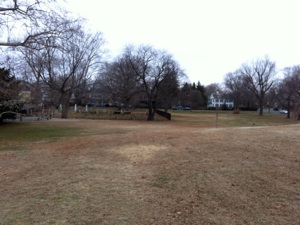
Stratford, clockwise from top left: 1. Stratford Green, which is brown at the moment. The surrounding area of the Stratford Historic District has a new England feel even though the evidence suggests culturally I have entered the New York sphere of influence. 2. “15 miles to NH” milestone on West Broad Street after the railroad underpass but before Barnum Avenue, right where it should be. 3. Another of the King’s Highway markers placed by the D.A.R. along the route. This one is immediately adjacent to a gas station (not shown at right). 4. Looking west on Boston Avenue (US1) in Stratford near the Bridgeport line.
Sunday, January 2, 2011

Walking the Post Road
The “Rosetta” Milestone which reads “14 Miles to NH” located in the grass at the intersection of East Broadway and Ferry Boulevard in Stratford, Connecticut. I used this stone to fix my position on a 1789 map of the road from Stratford to New York.
“ A mile or so west of the Housatonic River, the Post Road curves sharply as one enters the town of Stratford. No. 14 stands on the south side of the highway, just before one reaches the aforesaid curve. It is of light gray, field stone, cone shaped: about 2½ feet high; and bears a large and plainly read inscription. In 1924 this stone was uprooted from its location, but was later reset nearby. It bears the date 1768.”
Henry P. Sage, “Ye Milestones of Connecticut”, in Papers of the New Haven Historical Society, Volume X, 1951, 41-2.
Distance Walked in the Entry: 2.0 miles
Total Distance Walked in Connecticut: 104.6 miles
Total Distance Walked for this Project (from Boston): 275.1 miles
Distance Remaining to New York: 71.0 miles
Notes
-
1.Jean-Pierre Brissot de Warville, New Travels in the United States of America, translated by an Englishman, 1792. Edited by C.S. Van Tassel, 1919 for Great American Historical Classics Series (Bowling Green, Ohio: Historical Publications, Inc., 1919).
-
2.Henry P. Sage “ye Milsestones of Connecticut,” in Papers of the New Haven Colony Historical Society, Vol. X (New Haven: Printed for the Society, 1951), 42.
-
3.George Washington, The Diary of George Washington, From 1789 to 1791, edited by Benson J. Lossing (Richmond: The Press of the Historical Society, 1861), 22.
-
4.Reverend Samuel Orcutt, A History of the Old Town of Stratford and the City of Bridgeport in Connecticut, (New York: Tuttle, Morehouse, and Taylor, 1886), 390.
-
5.Alexander Hamilton, Itinerarium, 166.
-
6.William H. Wilcoxen, History of Stratford, Connecticut, 1639-1939 (Stratford, 1939), 191, 493-4, 626.
-
7.I used Nathanael Low’s Almanacs from the years 1767, 1775, and 1790 for tavern lists on “the Road to New York.” Low’s diaries can be found in Evan’s Early American Imprints, which I accessed from the website of the Boston Public Library.
-
8.Hamilton, 167.
-
9.Washington, 22.
-
10. James Birket, Some Cursory Remarks, 37-8.
-
11. Sarah Kemble Knight, Journal, 67.


